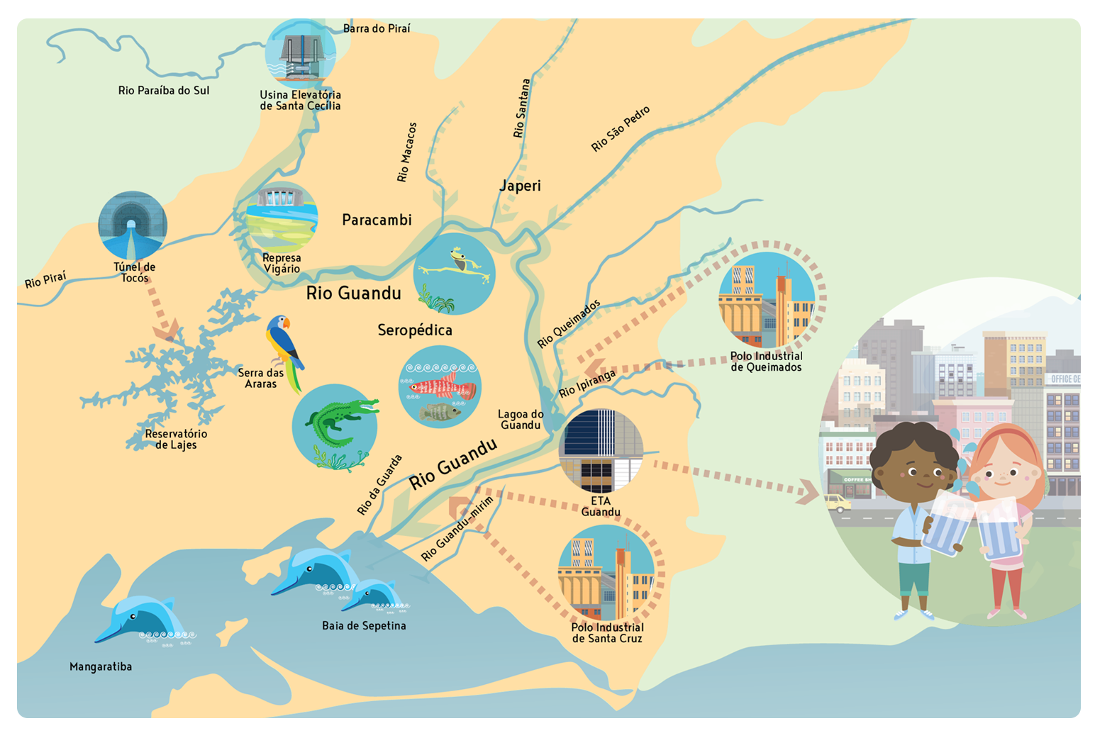
The Hydrographic Region II
The Hydrographic Basins of the Guandu, Guarda and Guandu-Mirim rivers, the area of influence of the Guandu-RJ Committee, make up Hydrographic Region II.

Guandu River Basin
Guandu is divided into two branches, having, in both, dams that belong to CEDAE. Joined to the east arm, is the Guandu lagoon. The rivers of Poços, Queimados and Ipiranga flow into it.
Downstream from the CEDAE island, the Guandu crosses a small stretch of rocky bed, forming a rapid. Then, it heads southwest and travels for about 9 km until it enters the São Francisco channel and continues for another 15 km until it flows into Sepetiba Bay.
Much of the Guandu comes from an important source: the Paraíba do Sul river. At Light’s hydroelectric plant, downstream from Santa Cecília, water is transposed through forced canalization at the plants. This movement causes about 60% of the waters of Paraíba do Sul to find the Ribeirão das Lajes River, which, in turn, flows down to form the Guandu and supply Rio de Janeiro.
Photo Gallery
Guarda River Basin
Its main tributaries are the Piloto, Cai Tudo and Itaguaí rivers. In the final stretch, the Guarda River presents, on its banks, strips composed of typical mangrove vegetation. From the vicinity of the old Rio-São Paulo road, the Guarda river runs through the urban area of Campo Lindo and the large sand exploration zone of the “Polígono de Piranema”, receiving the Valão do China on the left bank, which crosses the neighborhood of Campo Lindo, and, soon after, an agricultural area.
During the floods, several caves are flooded by the waters of the Valão dos Bois, when the fragile dikes break. The Valão dos Bois canal flows into the Rio da Guarda.
Photo Gallery
Guandu-Mirim River Basin
Its main tributaries are the Guandu do Sapê, Cabenga, dos Cachorros and Campinho rivers.
The current D. Pedro II-Guandu channel represents the diversion of the former course of the Guandu-Mirim river, whose bed marked the boundary between the former states of Rio de Janeiro and Guanabara, which ran out through the São Francisco Channel. With this modification, while the Guandu-Mirim river currently marks the border between the cities of Nova Iguaçu and Rio de Janeiro, the former riverbed, which is now dry, remains a political boundary between the municipalities.
Photo Gallery
